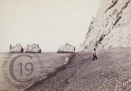
The Needle Rocks, Isle of Wight
A topographical carte-de-visite showing the Needle Rocks, as seen from Scratchell's Bay. The bay's shingle beach can only be reached by boat, as there is no access from the top of the cliff.
A row of three distinctive stacks of chalk that rise out of the sea off the western extremity of the Isle of Wight, close to Alum Bay, the Needle Rocks take their name from a fourth needle-shaped pillar called Lot's Wife, that collapsed in a storm in 1764. Although the remaining rocks are not at all needle-like, by then the name had become fixed in the popular imagination.
The Needles Lighthouse stands at the outer, western end of the formation. Built in 1859, it has been automated since 1994.
Photographed by Frank Mason Good.
Frank Mason Good had travelled to Egypt as assistant to Francis Frith in late 1857 and in 1864 he joined the Photographic Society. He lived at Hartley Wintney in Hampshire.
Code: 126089


